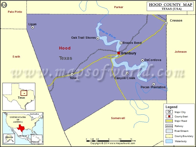
Check this Texas County Map to locate all the state’s counties in Texas Map. Mountain Peaks in Hood County Mountain Peak/Hill Elevation [Meter] Barnard Knob 292 Comanche Peak 373 Thompson Mountain 247 Airports…
Check this Texas County Map to locate all the state’s counties in Texas Map .
Mountain Peaks in Hood County
Mountain Peak/Hill
Elevation [Meter]
Barnard Knob
292
Comanche Peak
373
Thompson Mountain
247
Airports in Hood County
Airport Name
Barstool Ranch Airport
Granbury Regional Airport
Kvue-Tv Heliport
Nassau Bay Airport
Parker Airport
Pecan Plantation Airport
Shelton Private Heliport
The Landings Airport
Cities in Hood County
City
Population
Latitude
Longitude
Brazos Bend city
305
32.475267
-97.761353
Canyon Creek
916
32.392695
-97.740516
Cresson city
741
32.529886
-97.615387
DeCordova city
2683
32.427893
-97.691168
Granbury city
7978
32.447924
-97.768407
Lipan city
430
32.518651
-98.047055
Oak Trail Shores
2755
32.488479
-97.835657
Pecan Plantation
5294
32.362809
-97.655323
Tolar city
681
32.389437
-97.919093
Golf Courses in Hood County
Name of Golf Course
Latitude
Longitude
De Cordova Bend Country Club-Granbury
32.427498
-97.691949
Granbury Country Club-Granbury
32.443626
-97.763697
Harbor Lakes Golf Club-Granbury
32.426069
-97.766037
Hidden Oaks-Granbury
32.463936
-97.744848
Nutcracker Golf Club-Granbury
32.36371
-97.672895
Pecan Plantation Country Club-Granbury
32.362825
-97.686701
Starr Hollow Golf Club-Tolar
32.463368
-97.966764

 Wall Maps