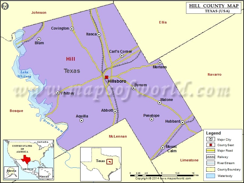
Check this Texas County Map to locate all the state’s counties in Texas Map. Mountain Peaks in Hill County Mountain Peak/Hill Elevation [Meter] Brushy Knob 232 Airports in Hill County Airport Name Bar…
Check this Texas County Map to locate all the state’s counties in Texas Map .
Mountain Peaks in Hill County
Mountain Peak/Hill
Elevation [Meter]
Brushy Knob
232
Airports in Hill County
Airport Name
Bar 16 Airport
Barnstormer Airport
Birdnest Airport
Circle ‘A’ Ranch Airport
Cross Wind Acres Airport
Gizmo Field
Lake Whitney State Park Airport
Reece Ranch Airport
Rocking A Airport
Ryan Aerodrome
Stapleton Field
The Landing Airport
Cities in Hill County
City
Population
Latitude
Longitude
Abbott city
356
31.88725
-97.08026
Aquilla city
109
31.854755
-97.220006
Blum town
444
32.141917
-97.397168
Bynum town
199
31.969071
-97.003078
Carl’s Corner town
173
32.084218
-97.052559
Covington city
269
32.178385
-97.260335
Hillsboro city
8456
32.007426
-97.115394
Hubbard city
1423
31.846987
-96.80032
Itasca city
1644
32.158549
-97.147766
Malone town
269
31.917028
-96.89474
Mertens town
125
32.058833
-96.893728
Mount Calm city
320
31.756559
-96.881746
Penelope town
198
31.858513
-96.928128
Whitney town
2087
31.95202
-97.319266
Golf Courses in Hill County
Name of Golf Course
Latitude
Longitude
Hillsboro Country Club-Hillsboro
32.014384
-97.109901
Lake Whitney Golf and Tennis Club-Whitney
31.994161
-97.360208
White Bluff Golf Club-Whitney
32.03038
-97.400149

 Wall Maps