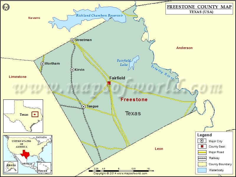
Freestone County Map, Texas
Check this Texas County Map to locate all the state’s counties in Texas Map. Mountain Peaks in Freestone County Mountain Peak/Hill Elevation [Meter] Burleson Hill 182 Folsom Hills 169 Pilot Knob 172 Airports…
Check this Texas County Map to locate all the state’s counties in Texas Map .
Mountain Peaks in Freestone County
Mountain Peak/Hill
Elevation [Meter]
Burleson Hill
182
Folsom Hills
169
Pilot Knob
172
Airports in Freestone County
Airport Name
Air Evac 53 Heliport
Big Brown Creek Airstrip
Moore Hx Ranch Airport
Pyramid Ranch Airport
Teague Municipal Airport
Cities in Freestone County
City
Population
Latitude
Longitude
Fairfield city
2951
31.718312
-96.169778
Kirvin town
129
31.767096
-96.330018
Streetman town
247
31.876142
-96.32379
Teague city
3560
31.629618
-96.280293
Wortham town
1073
31.78968
-96.460999
Golf Courses in Freestone County
Name of Golf Course
Latitude
Longitude
Big Cedar Country Club-Teague
31.631925
-96.268409

 Wall Maps