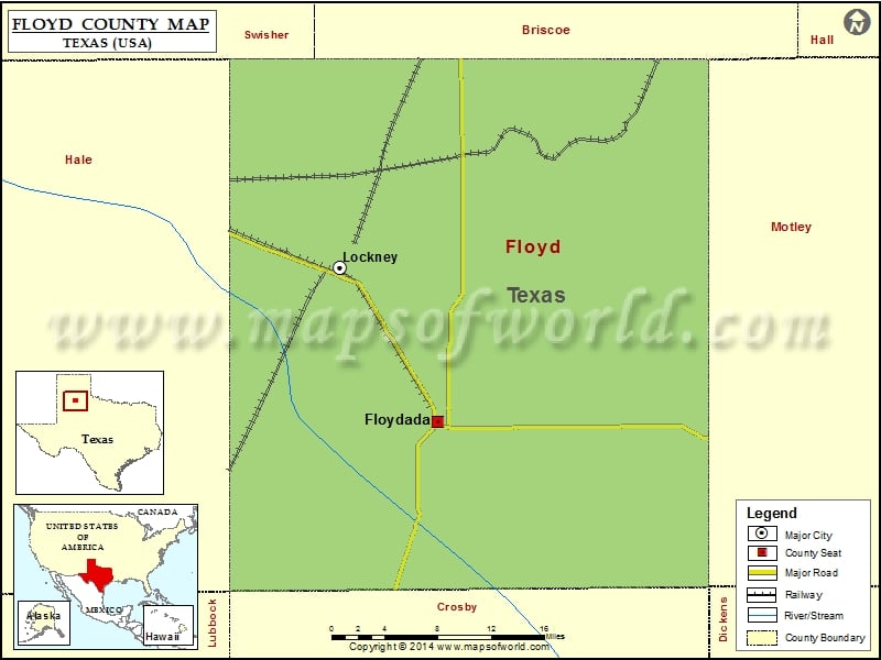
Check this Texas County Map to locate all the state’s counties in Texas Map. Mountain Peaks in Floyd County Mountain Peak/Hill Elevation [Meter] Quitaque Peaks 862 More Maps of Floyd County Floyd County…
Check this Texas County Map to locate all the state’s counties in Texas Map.
Mountain Peaks in Floyd County
| Mountain Peak/Hill |
Elevation [Meter] |
| Quitaque Peaks |
862 |
More Maps of Floyd County
Airports in Floyd County
| Airport Name |
| Floydada Municipal Airport |
| Outback Airport |
| Sherman Airport |
Cities in Floyd County
| City |
Population |
Latitude |
Longitude |
| Floydada city |
3038 |
33.983524 |
-101.336787 |
| Lockney town |
1842 |
34.123056 |
-101.442446 |
Golf Courses in Floyd County
| Name of Golf Course |
Latitude |
Longitude |
| Floydada Country Club-Floydada |
33.889138 |
-101.366593 |

 Wall Maps