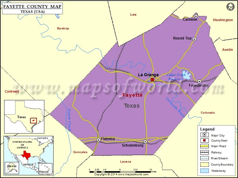
Fayette County Map, Texas
Check this Texas County Map to locate all the state’s counties in Texas Map. Mountain Peaks in Fayette County Mountain Peak/Hill Elevation [Meter] Hellers Hill 168 Indian Hill 101 Live Oak Hill 126…
Check this Texas County Map to locate all the state’s counties in Texas Map .
Mountain Peaks in Fayette County
Mountain Peak/Hill
Elevation [Meter]
Hellers Hill
168
Indian Hill
101
Live Oak Hill
126
Monument Hill
138
Obar Hill
181
More Maps of Fayette County
Airports in Fayette County
Airport Name
Anchorage Farm Field
Cherry Spraying Service Airport
El Paisano Airport
Fayette Regional Air Center Airport
Marty Ranch Airport
Piano Ranch Airport
Rocky Creek Ranch Airport
Thunderbird Southwest Airport
Ullrich Airport
Cities in Fayette County
City
Population
Latitude
Longitude
Carmine city
250
30.14853
-96.690431
Fayetteville city
258
29.906326
-96.675873
Flatonia town
1383
29.688689
-97.106101
La Grange city
4641
29.912918
-96.876805
Round Top town
90
30.06397
-96.695882
Schulenburg city
2852
29.681731
-96.907101
Golf Courses in Fayette County
Name of Golf Course
Latitude
Longitude
Flatonia Golf Course-Flatonia
29.686897
-97.092389
Frisch Auf Valley Country Club-La Grange
29.889953
-96.887082

 Wall Maps