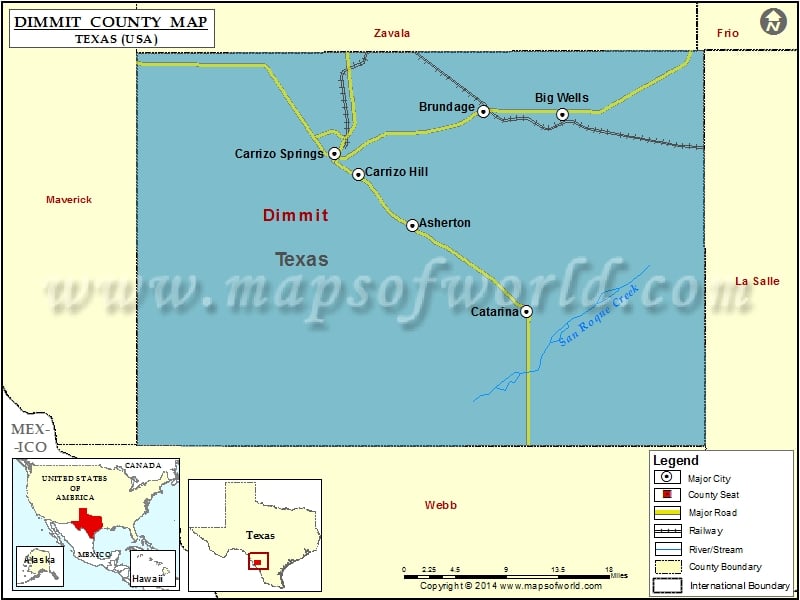
Check this Texas County Map to locate all the state’s counties in Texas Map. Airports in Dimmit County Airport Name Briggs Ranch Airport Briscoes Catarina Ranch Airport Dentonio Ranch Airport Diamond H Ranch…
Check this Texas County Map to locate all the state’s counties in Texas Map .
Airports in Dimmit County
Airport Name
Briggs Ranch Airport
Briscoes Catarina Ranch Airport
Dentonio Ranch Airport
Diamond H Ranch Airport
Dimmit County Airport
Faith Ranch Airport
Harrison Piloncillo Ranch Airport
Miller Ranch Airport
Price Ranch Airport
Rancho Ecantado Airport
San Pedro Ranch Airport
Tortuga Ranch Airport
Cities in Dimmit County
City
Population
Latitude
Longitude
Asherton city
1084
28.446118
-99.760322
Big Wells city
697
28.569875
-99.570188
Brundage
27
28.573965
-99.670131
Carrizo Hill
582
28.503269
-99.829464
Carrizo Springs city
5368
28.526601
-99.858879
Catarina
118
28.349852
-99.616061
Golf Courses in Dimmit County
Name of Golf Course
Latitude
Longitude
Carrizo Springs Municipal Golf Course-Carrizo Springs
28.531509
-99.829091

 Wall Maps