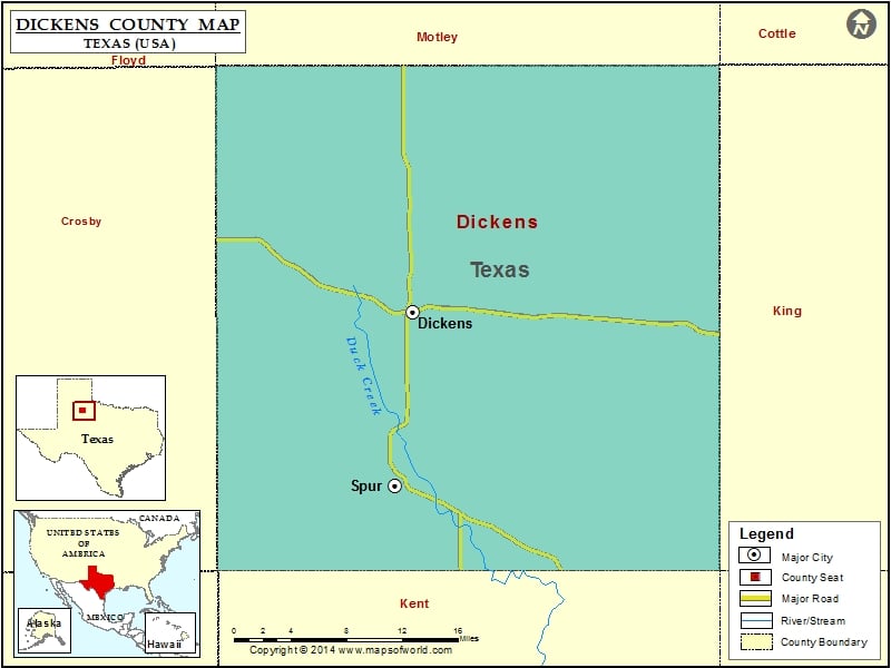
Dickens County Map, Texas
Check this Texas County Map to locate all the state’s counties in Texas Map. Mountain Peaks in Dickens County Mountain Peak/Hill Elevation [Meter] Cathey Hill 751 Croton Breaks 655 Haystack Mountain 880 Mackenzie…
Check this Texas County Map to locate all the state’s counties in Texas Map .
Mountain Peaks in Dickens County
Mountain Peak/Hill
Elevation [Meter]
Cathey Hill
751
Croton Breaks
655
Haystack Mountain
880
Mackenzie Peak
877
Negro Hill
798
Red Hill
709
Soldier Mound
757
Steele Hills
676
Airports in Dickens County
Airport Name
Beggs Ranch Airport
Gardner Farm Airport
Travis Field Airport
Cities in Dickens County
City
Population
Latitude
Longitude
Dickens city
286
33.621273
-100.836804
Spur city
1318
33.470109
-100.855657
Golf Courses in Dickens County
Name of Golf Course
Latitude
Longitude
Spur Golf Course-Spur
33.48428
-100.850632

 Wall Maps