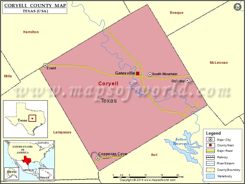
Coryell County Map, Texas
Check this Texas County Map to locate all the state’s counties in Texas Map. Mountain Peaks in Coryell County Mountain Peak/Hill Elevation [Meter] Anderson Mountain 372 Antelope Mound 318 Bagget Mountain 356 Bald…
Check this Texas County Map to locate all the state’s counties in Texas Map .
Mountain Peaks in Coryell County
Mountain Peak/Hill
Elevation [Meter]
Anderson Mountain
372
Antelope Mound
318
Bagget Mountain
356
Bald Knob
302
Blackwell Mountains
330
Bread Tray Mountain
275
Bushy Knob
337
Culp Mountain
356
Dalton Mountain
281
Elm Knob
307
Fletchers Point
415
Henson Mountains
313
Herzog Mountain
382
Hog Mountain
370
Jack Mountain
325
Jackson Knob
319
King Mountain
283
Langford Mountain
270
Lone Mountain
324
Long Mountain
389
Manning Mountains
349
McCluskey Mountain
356
Rattlesnake Hill
352
Reed Mountain
295
Riggs Mountain
274
Round Mountain
319
Shell Mountains
361
Smith Mountain
301
Stampede Mountan
332
Sugar Loaf Mountain
283
Twin Mountain
398
Twin Mountains
381
Williamson Mountain
340
Airports in Coryell County
Airport Name
Berry Airport
Gatesville Municipal Airport
Longhorn Aux Landing Strip
Metroplex Hospital Heliport
Shorthorn Aux Landing Strip
Tick Hill Airfield
Cities in Coryell County
City
Population
Latitude
Longitude
Copperas Cove city
32032
31.117056
-97.914358
Evant town
426
31.476426
-98.150185
Gatesville city
15751
31.443951
-97.733295
Oglesby city
484
31.418618
-97.511218
South Mountain town
384
31.439828
-97.679266
Golf Courses in Coryell County
Name of Golf Course
Latitude
Longitude
Gatesville Country Club-Gatesville
31.418811
-97.725405
Hills of Cove Municipal Golf Course-Copperas Cove
31.127099
-97.886693
Perry Country Club-Hamilton
31.615413
-97.880922

 Wall Maps