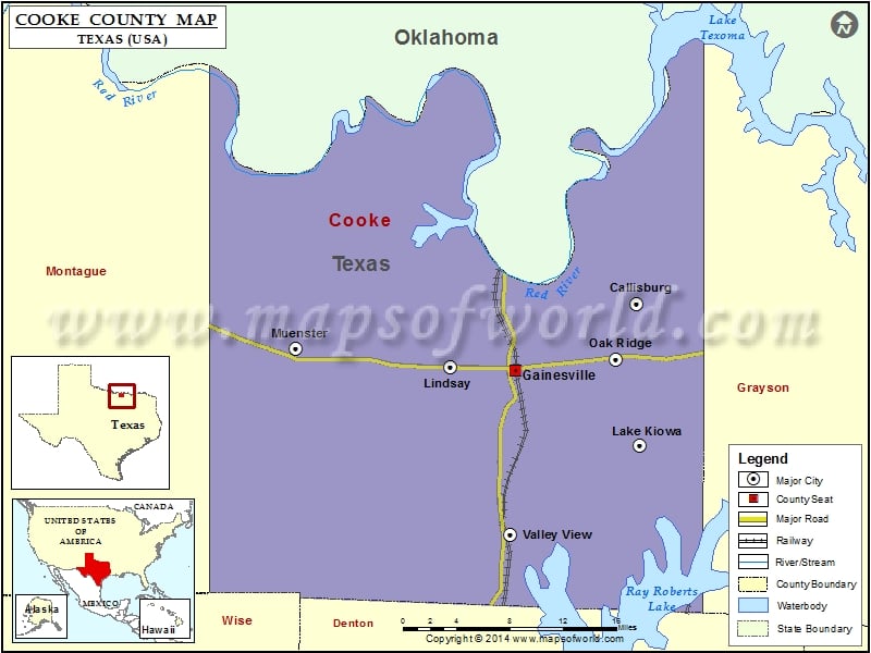
Check this Texas County Map to locate all the state’s counties in Texas Map. Mountain Peaks in Cooke County Mountain Peak/Hill Elevation [Meter] Mount Olive 255 Terrapin Hill 232 Three Mounds 290 Airports…
Check this Texas County Map to locate all the state’s counties in Texas Map .
Mountain Peaks in Cooke County
Mountain Peak/Hill
Elevation [Meter]
Mount Olive
255
Terrapin Hill
232
Three Mounds
290
Airports in Cooke County
Airport Name
At&T – Apache Junction Heliport
Bucker Field
Dreamland Airport
Edgington Ranch Airport
Flying R Ranch Airport
Freedom Field
Gainesville Municipal Airport
Hardy Field
Melody Ranch Airport
North Texas Medical Center Heliport
Robotek Airport
Ruby Field
Stoney Fork Landing Airport
Tailwheel Acres Airport
Three Acres Airport
Cities in Cooke County
City
Population
Latitude
Longitude
Callisburg city
353
33.698711
-97.015918
Gainesville city
16002
33.638475
-97.148438
Lake Kiowa
1906
33.570334
-97.012924
Lindsay city
1018
33.64176
-97.218017
Muenster city
1544
33.658801
-97.3872
Oak Ridge town
141
33.648122
-97.038507
Valley View city
757
33.489183
-97.153409
Golf Courses in Cooke County
Name of Golf Course
Latitude
Longitude
Gainesville Municipal Golf Course-Gainesville
33.646665
-97.20441
Lake Kiowa Golf Course-Lake Kiowa
33.569941
-97.013643
Turtle Hill Golf Course-Muenster
33.766191
-97.378293

 Wall Maps