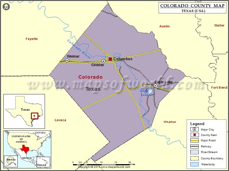
Colorado County Map, Texas
Check this Texas County Map to locate all the state’s counties in Texas Map. Mountain Peaks in Colorado County Mountain Peak/Hill Elevation [Meter] Alley Hill 59 Middle Brook Hill 62 Rocky Hill 137…
Check this Texas County Map to locate all the state’s counties in Texas Map .
Mountain Peaks in Colorado County
Mountain Peak/Hill
Elevation [Meter]
Alley Hill
59
Middle Brook Hill
62
Rocky Hill
137
Wilson Hill
71
Airports in Colorado County
Airport Name
Circle M Ranch Airport
Eagle Lake Airport
Eagle Lake Community Hospital Heliport
Mc Coy Bldg Sup 16 Heliport
Renz Ranch Airport
River Field
Robert R Wells Jr Airport
Cities in Colorado County
City
Population
Latitude
Longitude
Columbus city
3655
29.705471
-96.556253
Eagle Lake city
3639
29.587233
-96.328563
Glidden
661
29.697568
-96.590813
Weimar city
2151
29.700055
-96.777349
Golf Courses in Colorado County
Name of Golf Course
Latitude
Longitude
Columbus Golf Club-Columbus
29.705711
-96.560853
Eagle Lake Golf Course & Recreation Center-Eagle Lake
29.586948
-96.337938
The Falls Resort & Club-New Ulm
29.84865
-96.500847
Weimar Golf Club-Weimar
29.49659
-96.669049

 Wall Maps