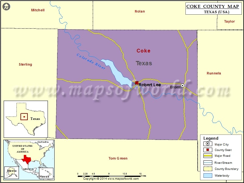
Check this Texas County Map to locate all the state’s counties in Texas Map. Mountain Peaks in Coke County Mountain Peak/Hill Elevation [Meter] Brooks Hill 610 Butterfield Peak 690 Buttermilk Hill 602 Cedar…
Check this Texas County Map to locate all the state’s counties in Texas Map .
Mountain Peaks in Coke County
Mountain Peak/Hill
Elevation [Meter]
Brooks Hill
610
Butterfield Peak
690
Buttermilk Hill
602
Cedar Mountain
583
Cement Mountain
709
Dead Indian Mountain
639
Deadman Hill
614
Durham Peak
763
Goat Mountain
796
Gobbler Hill
616
Green Mountain
778
Hayrick Mountain
729
Hog Mountain
594
Horse Mountain
765
Jones Peak
710
Juniper Peak
655
Kickapoo Mountain
745
Kiser Mountain
713
Little Round Mountain
703
Lone Mountain
735
Meadow Mountain
778
Millican Mountains
676
Mount Margaret
660
Nipple Peak
673
Nipple Peak
716
Sand Hill
690
Shaggy Peak
747
Silver Peak
696
Wildcat Mountain
740
Wilson Mountain
647
Airports in Coke County
Airport Name
Robert Lee Airport
Cities in Coke County
City
Population
Latitude
Longitude
Bronte town
999
31.885747
-100.295434
Robert Lee city
1049
31.895405
-100.485631
Golf Courses in Coke County
Name of Golf Course
Latitude
Longitude
Mountain Creek Golf Club-Robert Lee
31.900655
-100.479324
Singing Winds Golf Course-Bronte
31.90511
-100.294335

 Wall Maps