Check this Texas County Map to locate all the state’s counties in Texas Map. Mountain Peaks in Chambers County Mountain Peak/Hill Elevation [Meter] Barbers Hill 25 Cedar Hill 6 More…
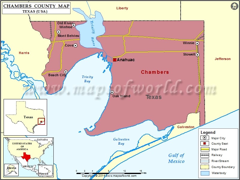
Check this Texas County Map to locate all the state’s counties in Texas Map.
Mountain Peaks in Chambers County
| Mountain Peak/Hill |
Elevation [Meter] |
| Barbers Hill |
25 |
| Cedar Hill |
6 |
More Maps of Calhoun County
Airports in Chambers County
| Airport Name |
| Chambers County Airport |
| Chambers County Winnie Stowell Airport |
| Cig 816 Heliport |
| Eagle Air Airport |
| Houston Oil & Minerals Smith Point Heliport |
| RWJ Airpark |
| Slack Airport |
Cities in Chambers County
| City |
Population |
Latitude |
Longitude |
| Anahuac city |
2243 |
29.764929 |
-94.678677 |
| Beach City city |
2198 |
29.727244 |
-94.85479 |
| Cove city |
510 |
29.810154 |
-94.820703 |
| Mont Belvieu city |
3835 |
29.852452 |
-94.881254 |
| Oak Island |
363 |
29.662867 |
-94.688093 |
| Old River-Winfree city |
1245 |
29.874446 |
-94.826774 |
| Stowell |
1756 |
29.78141 |
-94.379404 |
| Winnie |
3254 |
29.816718 |
-94.380675 |
Golf Courses in Chambers County
| Name of Golf Course |
Latitude |
Longitude |
| Chambers County Golf Course-Anahuac |
29.831755 |
-94.638848 |
| Eagle Pointe Golf Club-Mont Belvieu |
29.87445 |
-94.865539 |

 Wall Maps