Check this Texas County Map to locate all the state’s counties in Texas Map. Mountain Peaks in Carson County Mountain Peak/Hill Elevation [Meter] Antelope Peak 1019 Airports in Carson County…
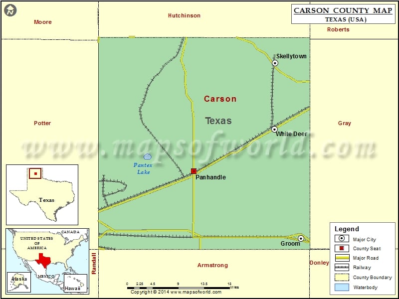
Check this Texas County Map to locate all the state’s counties in Texas Map .
Mountain Peaks in Carson County
Mountain Peak/Hill
Elevation [Meter]
Antelope Peak
1019
Airports in Carson County
Airport Name
Eagles Aerodrome
Panhandle Carson County Airport
Skellytown Airport
Stamps Field
Cities in Carson County
City
Population
Latitude
Longitude
Groom town
574
35.204968
-101.106954
Panhandle town
2452
35.346068
-101.380431
Skellytown town
473
35.571019
-101.173044
White Deer town
1000
35.433193
-101.175074
Golf Courses in Carson County
Name of Golf Course
Latitude
Longitude
Panhandle Country Club-Panhandle
35.33933
-101.386619

 Wall Maps