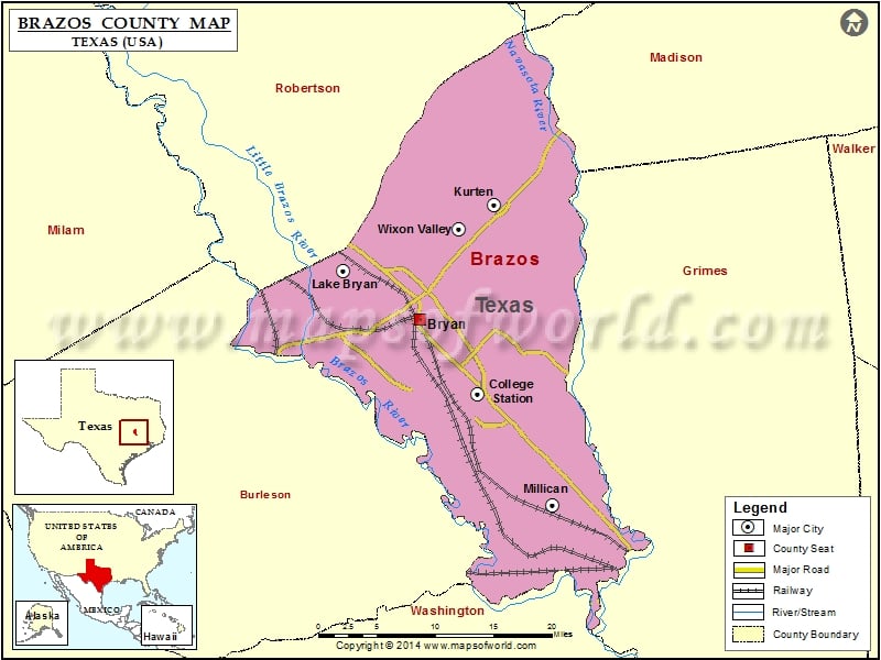
Check this Texas County Map to locate all the state’s counties in Texas Map. Airports in Brazos County Airport Name Big Bend Regional Medical Center Heliport Coulter Field Easterwood Field…
Check this Texas County Map to locate all the state’s counties in Texas Map .
Airports in Brazos County
Airport Name
Big Bend Regional Medical Center Heliport
Coulter Field
Easterwood Field
St Joseph Hospital Heliport
Texas A And M Flight Test Station Airport
Texas World Speedway Helistop Nr 1 Heliport
Texas World Speedway Helistop Nr 2 Heliport
Varisco Airport
Cities in Brazos County
City
Population
Latitude
Longitude
Bryan city
76201
30.666569
-96.366382
College Station city
93857
30.586762
-96.295796
Kurten town
398
30.789587
-96.275858
Lake Bryan
1728
30.718802
-96.463217
Millican town
240
30.466992
-96.203504
Wixon Valley city
254
30.763936
-96.319303
Golf Courses in Brazos County
Name of Golf Course
Latitude
Longitude
Briarcrest Country Club Inc-Bryan
30.656859
-96.334829
Bryan Municipal Golf Course-Bryan
30.63893
-96.360309
Miramont Country Club-Bryan
30.667745
-96.314482
Pebble Creek Country Club-College Station
30.568268
-96.245212
Texas A&M University Golf Course-College Station
30.62245
-96.340269
The Traditions Club At Texas A & M-Bryan
30.607081
-96.389444

 Wall Maps