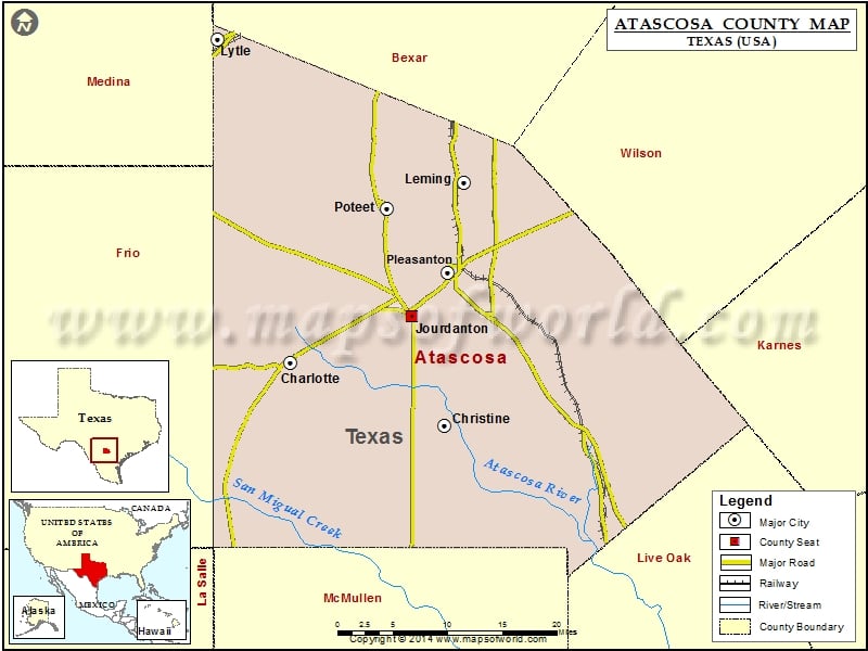
Atascosa County Map, Texas
Check this Texas County Map to locate all the state’s counties in Texas Map. Mountain Peaks in Atascosa County Mountain Peak/Hill Elevation [Meter] Lipan Hills 101 Lipan Hills 110 Tordillo…
Check this Texas County Map to locate all the state’s counties in Texas Map .
Mountain Peaks in Atascosa County
Mountain Peak/Hill
Elevation [Meter]
Lipan Hills
101
Lipan Hills
110
Tordillo Hills
153
Airports in Atascosa County
Airport Name
74 Ranch Airport
Arrow ‘S’ Ranch Airport
Dauenhauer Field Airport
Maurice Dauwe Farm Airport
Pleasanton Municipal Airport
Ranch-Aero Airport
South Texas Regional Hospital Heliport
Ten Oaks Airport
Cities in Atascosa County
City
Population
Latitude
Longitude
Charlotte city
1715
28.859069
-98.70048
Christine town
390
28.786322
-98.497799
Jourdanton city
3871
28.913729
-98.541071
Leming
946
29.068341
-98.472229
Lytle city
2492
29.233977
-98.79647
Pleasanton city
8934
28.96379
-98.493821
Poteet city
3260
29.037873
-98.57405
Golf Courses in Atascosa County
Name of Golf Course
Latitude
Longitude
Pleasanton Country Club-Pleasanton
28.973091
-98.481877

 Wall Maps