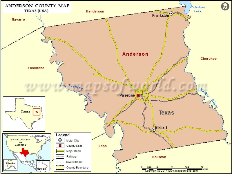
Anderson County Map, Texas
Check this Texas County Map to locate all the state’s counties in Texas Map. Airports in Anderson County Airport Name Deer Meadow Ranch Airport Glad Oaks Airport Lochridge Ranch Airport…
Check this Texas County Map to locate all the state’s counties in Texas Map .
Airports in Anderson County
Airport Name
Deer Meadow Ranch Airport
Glad Oaks Airport
Lochridge Ranch Airport
Meadowood Ranch Heliport
Palestine Municipal Airport
Palestine Regional Medical Center Heliport
W J E Airport
More Maps of Anderson County
Cities in Anderson County
City
Population
Latitude
Longitude
Elkhart town
1371
31.627968
-95.578968
Frankston town
1229
32.056093
-95.50436
Palestine city
18712
31.754715
-95.647174
Golf Courses in Anderson County
Name of Golf Course
Latitude
Longitude
Elkhart Golf Club-Elkhart
31.628314
-95.554025
Meadowbrook Country Club-Palestine
31.796163
-95.630481
Pine Dunes Resort-Frankston
32.06557
-95.501436

 Wall Maps