Rhode Island Topographic Map
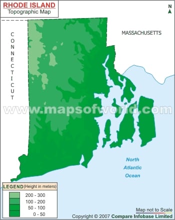
Rhode Island Topographic Map shows the geography and trends in the elevation of the RI on original scale.

Rhode Island Topographic Map shows the geography and trends in the elevation of the RI on original scale.
This website uses cookies to improve your experience. We'll assume you're ok with this, but you can opt-out if you wish. Read More