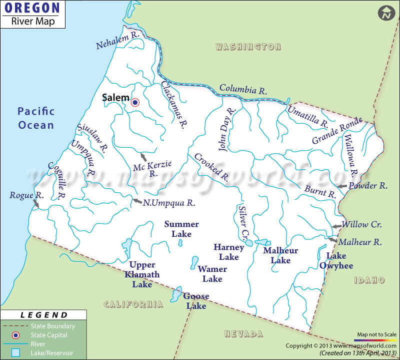
The Oregon River Map clearly indicates the several rivers, streams and lakes flowing through the state. Crooked, Sandy, Grande Ronde, White, Clackamas, Wallowa, Salmon, John Day, Rogue, Deschutes, Willamette, McKenzie, Owhyee and North Umpqua are some of the important rivers of Oregon. The State of Oregon falls under the watershed drainage area of the Pacific Ocean. Rogue, Nehalem and Umpqua rivers flow through the western part of the state. River Columbia is the largest river of the state and flows through John Day, Umatilla and Deschutes. River Clackamas offers the tourists with a plethora of adventurous activities of fishing and boating.
River Grande Ronde flows through Wallowa-Whitman National Forest. Several natural lakes flow across the State of Oregon. The Upper Klamath Lake is the biggest lake of the state that drains total area of 58,922 acres. Crater Lake is one of the most interesting tourist destinations of Oregon. The Crater Lake was the result of the sudden volcanic eruption of Mt. Mazama which led to the creation of a big crater. Summer Lake, Harney Lake, Lake Albert, Goose Lake and Fern Ridge Lake are some of the famous lakes of Oregon. The Oregon State Map provides comprehensive information on accurate location of the several rivers of the state.

 Wall Maps