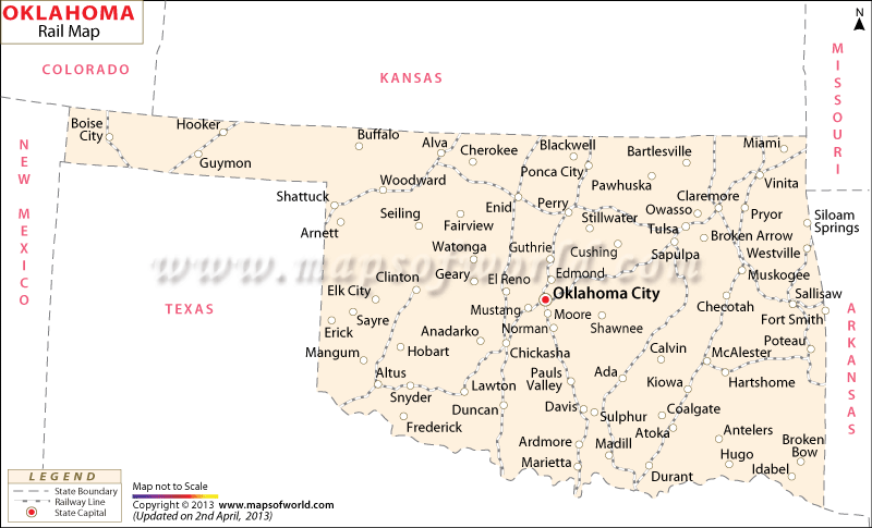
The Oklahoma Railway Map points out the towns and counties that are well-connected through the rail network of the state.
Such towns as Oklahoma City, Tulsa, Woodward, Ardmore, Hooker, Vinita, Shattuck, Cherokee, Pauls Valley, Durant, Alva, Davis, Ponca City, Magnum, Cleveland, El Reno and many others are highlighted in the railway map of Oklahoma. Union Pacific, Santa Fe and Burlington Northern are some of the major railroads of Oklahoma state which offer regular train services. 6281 km of total railway track was available in the state of Oklahoma in the year of 2000.
According to the official records the railways started operating in the state on a full-fledged basis from the year 1930.
Amtrak which provides trains to various states of USA also operates in the Oklahoma state. The Heartland Flyer of Amtrak passes through the state of Oklahoma. Some other prominent railroad organizations of Oklahoma state include Kiamichi railroad, BNSF Railway, Sand Springs Railway, Cimarron Valley railroad, among others. Information about the railway routes can be available from the Oklahoma state map too. Besides the railway lines of the state, the Oklahoma railway map also indicates the states of Kansas, Texas, Arkansas, Colorado, Missouri and New Mexico.

 Wall Maps