Rivers in Ohio
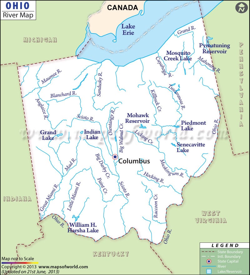
The Ohio River Map provides detailed information on the various rivers, lakes and streams flowing through the state. Some of the major rivers include Maumee, Scioto, Ohio, Cuyahoga, Sandusky, Muskingham and Miami.
The rivers in the northern part of the state flow into the Great Lakes. The rivers of the Southern part of the Ohio flow into River Ohio. The Southern region of Ohio falls under the watershed drainage area of The Mississippi River. The Portage, Cuyahoga, Maumee and Sandusky all run through the northern part of Ohio. The Scioto, Muskingham, Raccoon, Miami and Little Miami flow through the southern part of Ohio. The Division of Natural Areas and Preserves of Ohio categorized 13 rivers as being the most scenic rivers. Kokosing, Mohican and Olentangy are some of the prominent recreational and scenic rivers of Central Ohio. Grand, Little Beaver Creek and Upper Cuyahoga are few notable rivers of Northeast Ohio. Sandusky and Maumee Rivers run across Northwest Ohio. Greenville and Little Miami drain the southwestern part of the state.The prominent lakes of Ohio are the Grand Lake and Erie Lake.

 Wall Maps