 Wall Maps
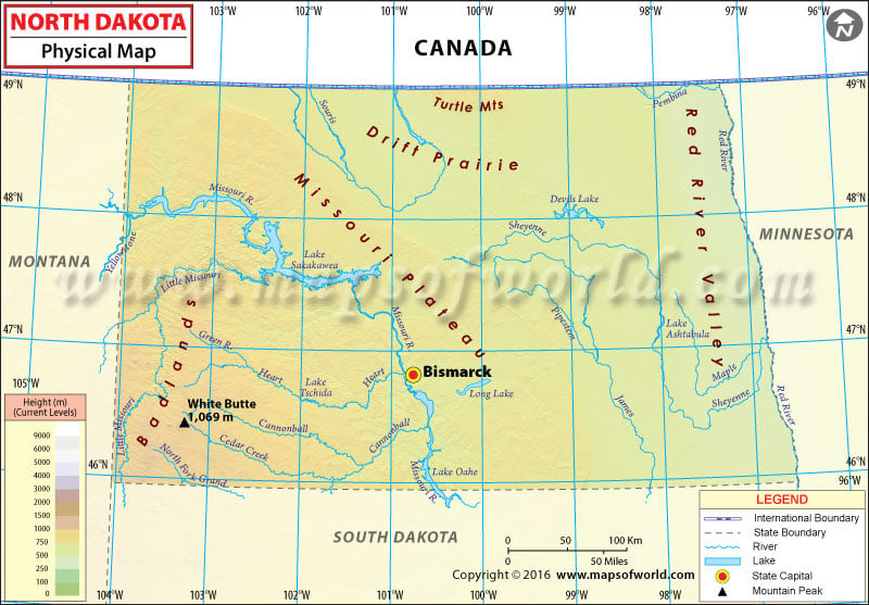
Physical Map of North Dakota shows rivers, lakes, mountain peaks, elevations, plateaus, plains and other topographic features of the state of North Dakota, USA.

Physical Map of North Dakota shows rivers, lakes, mountain peaks, elevations, plateaus, plains and other topographic features of the state of North Dakota, USA.
Physical Map of North Dakota shows rivers, lakes, mountain peaks, elevations, plateaus, plains and other topographic features of the state of North Dakota, USA.
This website uses cookies to improve your experience. We'll assume you're ok with this, but you can opt-out if you wish. Read More