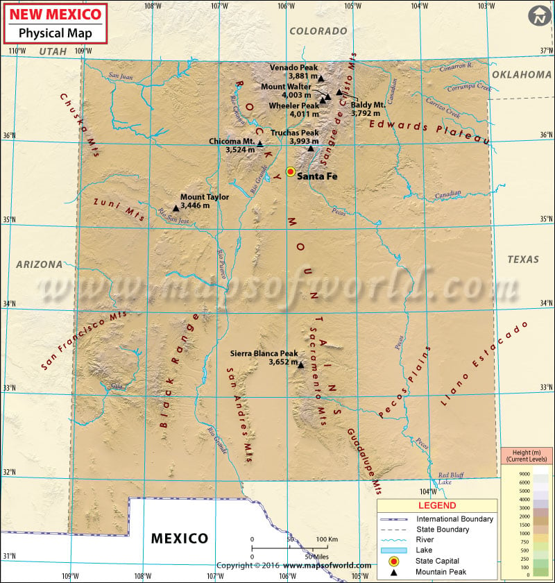
Physical Map of New Mexico
New Mexico is located in the southwestern region of the United States. The landscape of New Mexico is wide and varied. The landscape is characterized from deserts and broken mesas to peaks that are covered with snow. Despite that many parts of the state, especially the north, is marked by mountain wilderness.
A sub-range of the Rocky Mountains, the Sangre de Cristo Mountains are located in the northern part of New Mexico and also cover the southern part of Colorado. The Wheeler Peak, with a height of 13,167 feet, is the highest point in the state. Other prominent mountains located in New Mexico are Shiprock, Valles Caldera, Mount Taylor, Baldy Mountain, and many others. Some important rivers that run through New Mexico are Pecos, Rio Grande, Gila, Canadian, and San Juan. Creosote bush, cactus, desert grasses, yucca etc can be found in the broad and semiarid plains. New Mexico shares its borders with Arizona, Texas, Colorado, Utah, and Oklahoma. New Mexico also shares its borders with the Mexican states of Chihuahua, and Sonora.
The Physical Map of New Mexico will give you more information on the physical features of the state. Listed on the map are the mountain rangers, rivers and other features. It is an important guide for students, teachers and researchers.

 Wall Maps