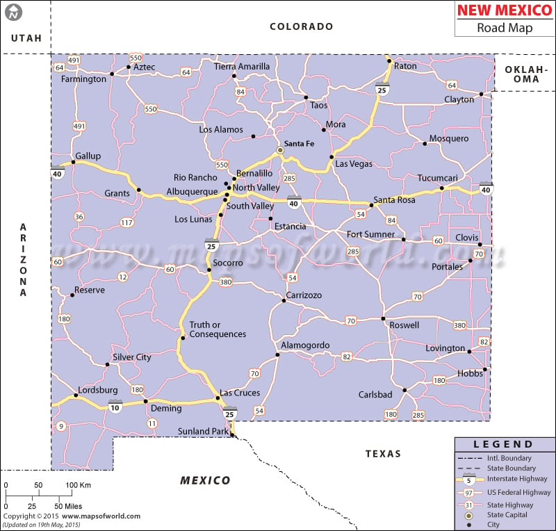
The New Mexico Road Map clearly indicates the several state roads and national highways passing through the state.The Interstate 25 easily connects the northern end of the state with the southern part of New Mexico.
The eastern part of New Mexico is joined with the western region by Interstate 40 and Interstate 10. New Mexico had 59,927 miles of streets and public roads in 2000. The excellent roadway system of New Mexico contributes to intra- and inter-state transportation. El Camino Real is one of the most important roads that connect the other cities of New Mexico with the capital city of Santa Fe and Santa Fe Trail. According to the official data of 2000, New Mexico had 1,557,064 vehicles that were registered under the State Registration Act, which included 3,440 public buses, 729,727 automobiles, 28,554 scooters and 795,343 trucks. The New Mexico State Highway and Transportation Department helps in maintaining old roads and building new roads.
The prominent cities of Famington, Albuquerque, Santa Fe, Deming, and Carlsbad are well connected by US Highways and Interstate Highways running through New Mexico.
The New Mexico State Map serves as a useful guide for tourists and local inhabitants of the state.

 Wall Maps