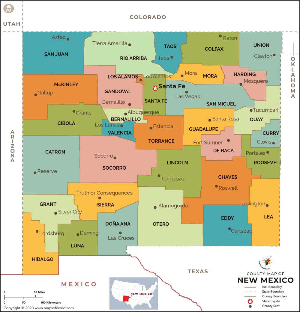
The New Mexico County Map indicates the political and administrative sub-divisions of the state. The state of New Mexico is divided into 33 counties for administrative convenience. Each County is efficiently administered by the County Seat.
Some important Counties of New Mexico are:
-
Eddy County :
Eddy County is spread over a total area of 4,182 square miles and has a population of 51,658, according to the census of 2000.
-
Luna County :
Luna County came into prominence in 1901. The County of Luna encompasses a total area of 2,965 square miles.
-
Catron County :
Catron County covers a total area of 6,928 square miles. According to the 2000 census, Catron County has a population of 3,543.
-
Grant County :
Grant County was established in 1868. Silver City is the County Seat of Grant County.
-
Bernalillo County :
Bernalillo County is spread over a total area of 1,166 square miles. It has a population of 556,678, according to the 2000 census.
-
Mora County –
Established in 1859, Mora County covers a total area of 1,931 square miles.
The New Mexico State Map points out the exact geographical position of each County.
Locations in New Mexico State Map :
-
Neighboring States :
Arizona, Colorado, Utah, Oklahoma, Texas
-
Neighboring country :
Mexico

 Wall Maps