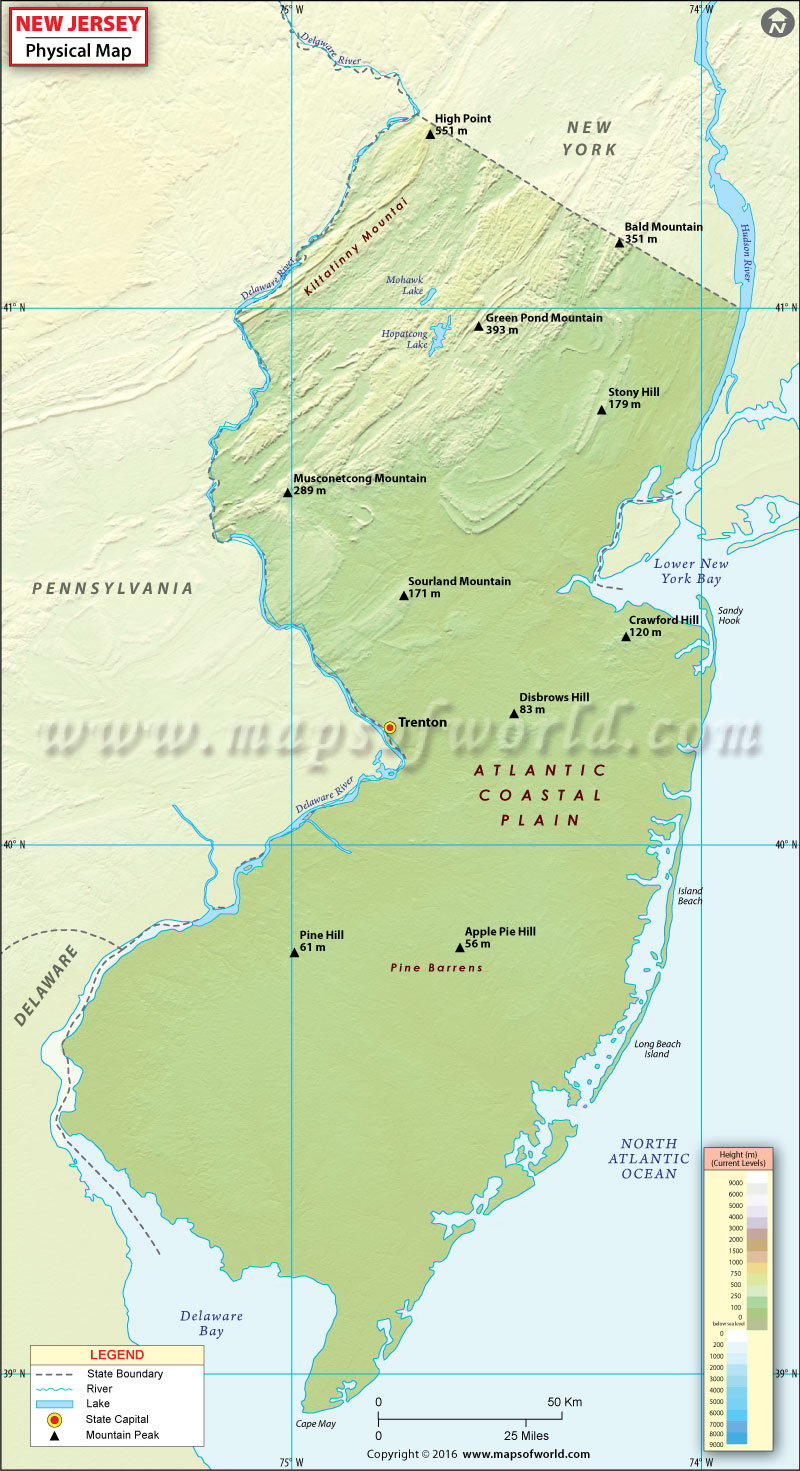
The geography of New Jersey is varied given a relatively small area of the state. The state has five major physical regions: Ridge-and-valley Appalachians, Highlands, Newark Basin Piedmont, Inner Coastal Plain, and Outer Coastal Plain.
- The Appalachian Valley and Ridge covers the northwestern corner of New Jersey and comprises the Kittatinny Mountains, the popular Delaware Water Gap, and smaller valleys. The region is home to the state’s highest peak known as High Point, at 550 meters (1,803 feet).
- The New Jersey Highlands region features Ramapo Mountains, Hunterdon Plateau, and Musconetcong ridge. The Amwell Valley lies between the Hunterdon Plateau and the Sourland Mountains.
- A sub-region of Piedmont Plateau, the Newark Basin Piedmont in northern New Jersey extends from New York’s Rockland County to the southeastern Pennsylvania border. The region features a wide range of elevation between The Palisades and the Watchung Mountains.
- Known for having fertile soil, the Inner Coastal Plain region includes lowlands and rolling hills. It stretches below the Piedmont fall line.
- Agriculturally poorer than Inner Plains, the Outer Coastal Plain covers a large area in South New Jersey. The Pine Barrens, or the Pinelands, is a densely forested area in the region and features at least 850 species of plants.

 Wall Maps