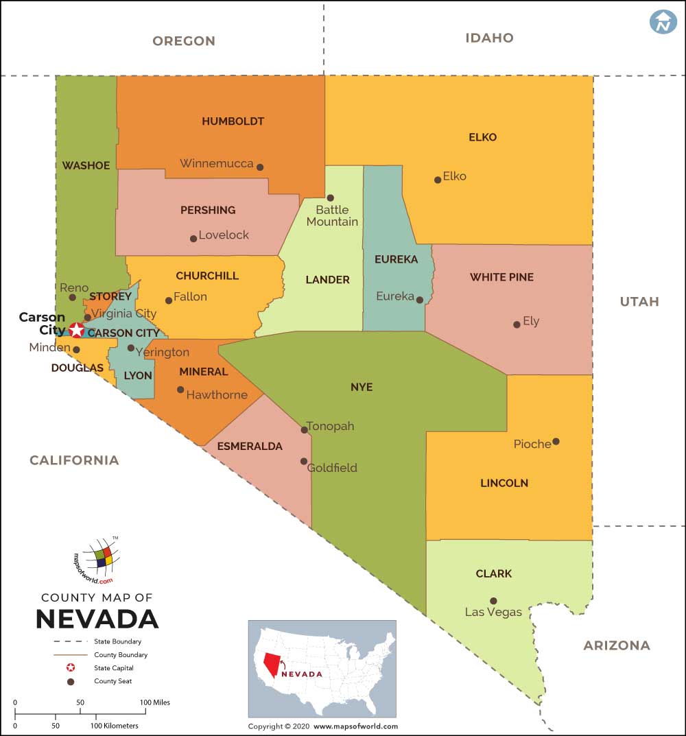
How Many Counties are in Nevada?
In the US State of Nevada, there are 17 counties. While Nye County is the largest county in terms of area, Carson City County is the smallest. In terms of population, the largest counties are Clark County, Washoe County, Lyon County, Carson City, Elko County, Nye County, Douglas County, etc.
Our Nevada Counties Map shows all 17 counties in Nevada. Counties are divisions of government within a state, and each county is administered from a county seat.
Information on a few of the 17 Counties in Nevada (as per the census of 2000):
- Lander county, founded in 1862, occupies a total area of 5494 sq miles and has a population of 5794.
- Churchill county, founded in 1861, covers a total area of 4929 sq miles and has a population of 23,982.
- Lyon county, founded in 1861, occupies a total area of 1994 sq miles and has a population of 34,501.
- White Pine county, founded in 1869, spans an area of 8877 sq miles and has a population of 9181.
- Douglas county, founded in 1861, occupies a total area of 710 sq miles and has a population of 41,259.
- Pershing county, founded in 1919, occupies a total area of 6009 sq miles and has a population of 6693.
- Clark county, founded in 1909, occupies a total area of 7911 sq miles and has a population of 1,375,765.

 Wall Maps