Wall Maps
More Maps of Lincoln County
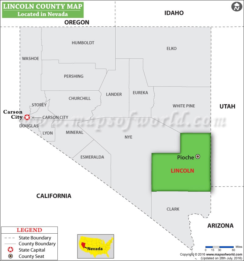
Lincoln County Nevada Map
Lincoln County Nevada Map shows the county’s location, the county seat, neighbouring counties, the state capital, and many more. Lincoln County is located in southeastern Nevada. Its total area is 10,637 sq mi (27,550 sq km), where 10,633 sq mi (27,540 sq km) land area and 3.8 sq mi (10 sq km) is water area. Pioche is the county seat and Caliente is the largest city.