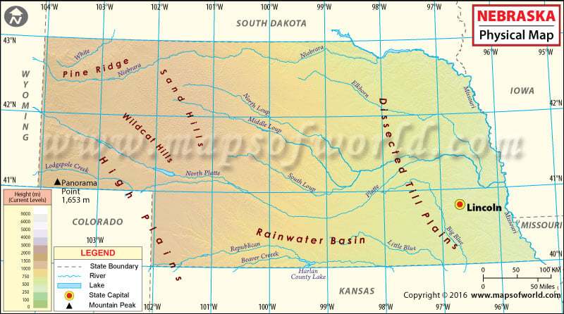
Located in Midwestern United States, Nebraska is the 16th most extensive state of the country. The state covers an area of 77,358 square miles. The state shares its borders with South Dakota, Iowa, Missouri, Kansas, Colorado, and Wyoming. The state comprises two major land regions which are the Great Plains and Dissected Till Plains. While the Great Plains which lie in the western part of the state are characterized by treeless prairie, the Dissected Till Plains comprises gently rolling hills. The Sand Hills is one of Nebraska’s prominent geographical feature. Sand Hills is spread across 23,000 square miles in the central and west-central territory of Nebraska. It is home to many lakes and marshes.
Some prominent rivers that run through the state are Republican River, Platte River, Niobrara River, Missouri River, Keya Paha River, amongst others. The highest point in the state is the Panorama Point which has a height of 1654 meters or 5242 feet. Other prominent mountains in the state are Hogback Mountain, Mount Edna, and Lovers Leap Butte to name a few.

 Wall Maps