About Nebraska
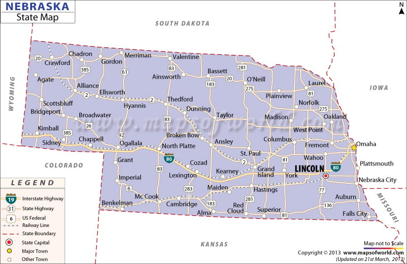
Nebraska is the 16th largest state in America by area. The ‘Cornhusker State’ is famous for pioneer history, fertile agricultural land, ingenious roadside attractions, and unpredictable weather. There are 93 counties in Nebraska
The state has two major geographical regions: the Dissected Till Plains and the Great Plains. The state is split into two time zones, Central Time (eastern Nebraska) and Mountain Time (western Nebraska). With an elevation of 1,653 meters, Panorama Point is the highest point in the state.
Lincoln is the state capital and has the second tallest capitol building in America. Situated on the Missouri River, Omaha is the largest city of in the state and is referred as the “Gateway to the West.” Other major cities in Nebraska are: Bellevue, Grand Island, Kearney, Fremont, and Hastings.
Tourist Attractions in Nebraska
- Henry Doorly Zoo and Aquarium in Omaha
- Scotts Bluff National Monuments
- Chimney Rock National Historic Site
- State Capitol in Lincoln
- Indian Cave State Park
- Agate Fossil Beds National Monument
- Fort Robinson State Park
Getting In and Around
Eppley Airfield (IMA) in Omaha is the busiest airport in Nebraska.
Amtrak’s California Zephyr, which runs between Chicago and Emeryville in California, traverses the state.
The state has more than 80 exits along the Interstate 80 (I-80) which runs from east to west.

 Wall Maps