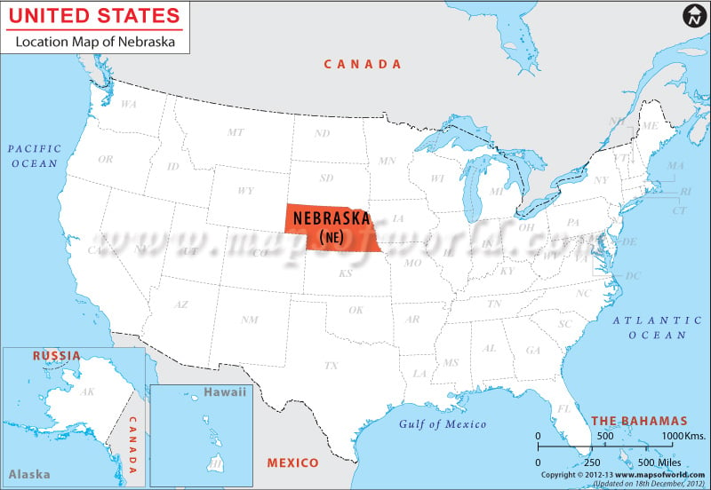
Nebraska location map indicates that the state lies towards the central part of country. Wyoming in the west, Colorado is the Southwest, Kansas in the south, Missouri in the south east, Iowa in the east and South Dakota in the north are the neighboring states indicated in Nebraska location map.
The state of Nebraska is located on the Great Plains lying in the Midwestern and western part of United States. The state lying latitudinal between 40°N to 43°N and longitudinally between 95°19’W to 104°03’W, has a total area of 77,421 square miles. Lincoln is the state capital and Omaha is the largest city of Nebraska. The state has 93 counties and is split into Central Time zone and Mountain Time zone.
Facts About Nebraska |
|---|
| State Name | Nebraska |
| Country | USA |
| Continent | North America |
| Capital | Lincoln |
| Largest city | Omaha |
| Area | 77,354 sq mi (200,520 km2) |
| Population | 1,881,503 (2014 est) |
| Lat Long | 41° 30′ 0″ N, 100° 0′ 0″ W |
| Official Language | English |
| Calling Code | |
| Time Zone | Central: UTC −6/−5 panhandle Mountain: UTC −7/−6 |
| Airport | 9- Airports Commercial service |
| Neighbour State | South Dakota, Wyoming, Kansas, Lowa |
| Internet TLD | .ne |
| Currency | United States dollarb (USD) |

 Wall Maps