
 Wall Maps
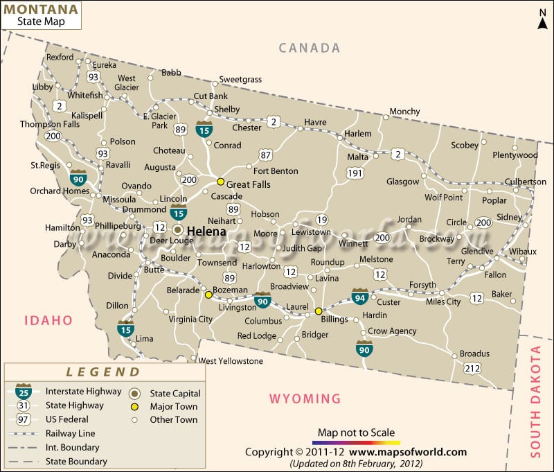
About the Montana State
Montana is the fourth largest state in the United States, and the largest landlocked state in the country, with an area of 147,042 square miles (381,154 square kilometers). With a total population of just under one million people, Montana ranks as the seventh least populous state in the country, and has the third lowest population density.
Known for its scenic landscapes Montana is home to Glacier National Park, Little Bighorn Battlefield, and part of Yellowstone National Park.
Only one of Montana’s cities has a population greater than 100,000, and that’s the capital in Billings. The other cities with a sizeable population are Missoula and Great Falls, along with metropolitan areas Bozeman, Butte, Helena and Kalispell.
ACOD~20120926