
 Wall Maps
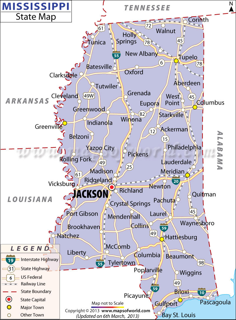
Nicknamed ‘The Magnolia State’, Mississippi is known for rich history, southern hospitality, and moth-watering cuisine. There are 82 counties in the state. Yazoo County is the largest by area while Hinds County is the most populous.
Jackson, the state capital and largest city, is called the “Crossroads of the South.” The city is famous for Gospel, Blues, and Jazz music scene. Tupelo is the birthplace of Elvis Presley, the “King of Rock and Roll.”
Tourist Attractions in Mississippi
- Vicksburg National Military Park
- Natchez Trace Parkway
- Elvis Presley Birthplace & Museum
- Gulf Islands National Seashore
- Buccaneer State Park
- Old Mississippi State Capitol
- Mississippi Museum of Natural Science
- Vicksburg National Cemetery
Getting In and Around
Jackson–Evers International Airport (JAN) and Gulfport–Biloxi International Airport (GPT) are busiest airports in Mississippi.
Amtrak operates two passenger trains through the state, City of New Orleans and Crescent.
Interstate highways (I-55, I-59, I-20, and I-22) and state highways traverse the state.