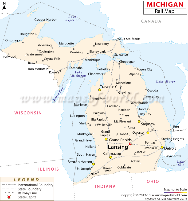
The Michigan Rail Map provides a complete overview of the several rail routes of the state.
The State of Michigan is connected by well laid railway tracks. In 1830, the foremost railroad company of Michigan was founded in the Midwest region of the state. Now, passenger trains are among the cheapest and most comfortable modes of transportation in the state.
Most of the passenger trains are provided by Amtrak, which runs five trains throughout the state. Cedar, Fowler, Milan, Niles, Battle Creek, Three Oaks, Big Rapids and South Haven are some of the more important railway depots, however railway lines are spread all over the state. All the important towns, including Detroit, Benton Harbor, Grand Rapids, Kalamazoo, Lansing, Flint, Saginaw, Traverse City, and Mackinaw City are easily accessible by railway routes. The Department of Transportation has, in recent years, helped to build new railway tracks and improve rail services of within the state.
The Michigan State Map shows the important railway stations of the state.

 Wall Maps