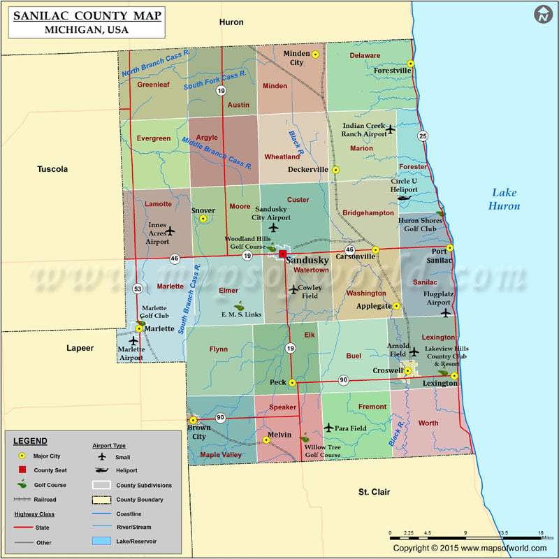
Airports in Sanilac County Airport Name Arnold Field Circle U Heliport Cowley Field Gilbert Field Indian Creek Ranch Airport Marlette Airport Mckimmy Field Para Field Sandusky City Airport Cities…
Airports in Sanilac County
Airport Name
Arnold Field
Circle U Heliport
Cowley Field
Gilbert Field
Indian Creek Ranch Airport
Marlette Airport
Mckimmy Field
Para Field
Sandusky City Airport
Cities in Sanilac County
City
Population
Latitude
Longitude
Applegate village
248
43.355363
-82.637063
Brown City city
1325
43.21137
-82.987918
Carsonville village
527
43.425842
-82.672982
Croswell city
2447
43.273652
-82.617731
Deckerville village
830
43.526527
-82.742033
Forestville village
136
43.659867
-82.612562
Lexington village
1178
43.267336
-82.536966
Marlette city
1875
43.326892
-83.081026
Melvin village
180
43.18643
-82.861653
Minden City village
197
43.671435
-82.776838
Peck village
632
43.258767
-82.816938
Port Sanilac village
623
43.428649
-82.54476
Sandusky city
2679
43.421006
-82.833364
Snover
448
43.465294
-82.970879

 Wall Maps