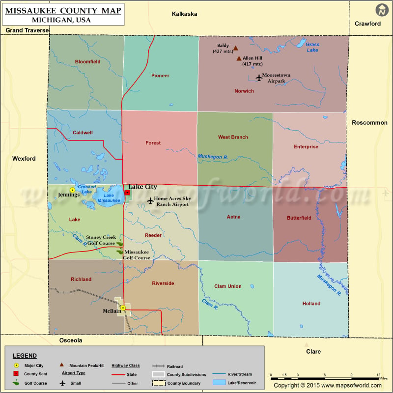
Michigan Counties Missaukee County Map Vishul MalikApril 3, 202501.6K views Mountain Peaks in Missaukee County Mountain Peak/Hill Elevation [Meter] Allen Hill 417 Baldy 427 Airports in Missaukee County Airport Name Barber Airport Home Acres Sky Ranch Airport Cities… Buy Printed MapBuy Digital MapWall MapsCustomize Mountain Peaks in Missaukee County Mountain Peak/Hill Elevation [Meter] Allen Hill 417 Baldy 427 Airports in Missaukee County Airport Name Barber Airport Home Acres Sky Ranch Airport Cities in Missaukee County City Population Latitude Longitude Jennings 264 44.332482 -85.296872 Lake City city 836 44.329721 -85.20848 McBain city 656 44.196044 -85.215373

 Wall Maps