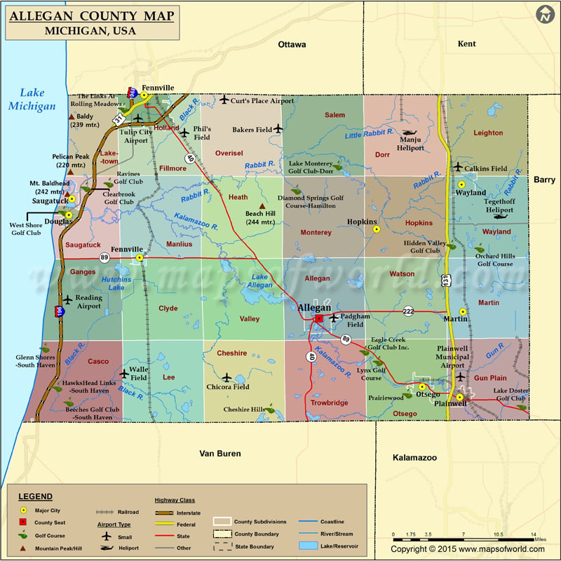
Mountain Peaks in Allegan County Mountain Peak/Hill Elevation [Meter] Baldy 239 Beach Hill 244 Mount Baldhead 242 Pelican Peak 220 Airports in Allegan County Airport Name Bakers Field Calkins Field…
Mountain Peaks in Allegan County
Mountain Peak/Hill
Elevation [Meter]
Baldy
239
Beach Hill
244
Mount Baldhead
242
Pelican Peak
220
Airports in Allegan County
Airport Name
Bakers Field
Calkins Field
Chicora Field
Curt’s Place Airport
Manju Heliport
Padgham Field
Phil’s Field
Plainwell Municipal Airport
Reading Airport
Tegethoff Heliport
Tulip City Airport
Walle Field
Cities in Allegan County
City
Population
Latitude
Longitude
Allegan city
4998
42.529955
-85.846195
Douglas city
1232
42.641088
-86.208393
Fennville city
1398
42.594764
-86.10519
Holland city
33051
42.767599
-86.098579
Hopkins village
610
42.625054
-85.763345
Martin village
410
42.537049
-85.638919
Otsego city
3956
42.457035
-85.697493
Plainwell city
3804
42.445818
-85.643355
Saugatuck city
925
42.656955
-86.205192
Wayland city
4079
42.672488
-85.640749

 Wall Maps