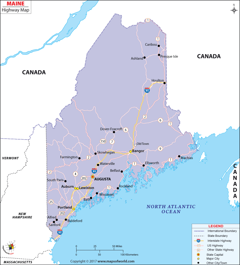
The Maine Road Map indicates the several national highways and roads running through the state. The well maintained roadways help in the intra and inter state connectivity of Maine.
All the important cities of the State of Maine are connected by the good roads. The northern end of the state is connected with the southern part of Maine by the Interstate Highways of 295 and 95.
The cities of Madawaska, Ashland, Houlton, Danforth, Topsfield, Lincoln, Newport, Skowhegan, Augusta, Auburn, Brunswick, Portland and Biddeford are easily accessible by the well laid roadways of the state of Maine. The state had total length of 36,483 km of public road during the year of 2000. Most of the population use public road for moving from one part of the state to another part.
I-95 and Turnpike are the important highways that pass through Maine and connect the state with the other states of the United States of America. The transport department of Maine builds new roads and maintains old roads of the state. The roads of Maine have different color codes to indicate the sweeping curves and unpaved roadways of the state. The Maine State Map is a useful guide for tourists as well as the local inhabitants of the state.

 Wall Maps