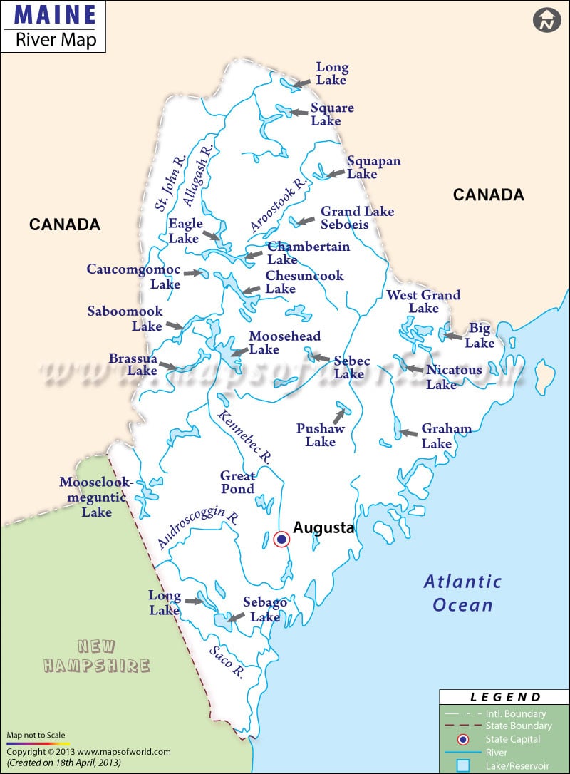
Maine River Map presents a comprehensive overview of the various natural streams of the state. St. John is the longest river of Maine. The river map of Maine clearly marks the various waterways that play a significant role in developing and preserving the natural as well as commercial interest of the state.
St. Croix, Ducktrap River Basin, Saco River Basin, Eastern Coastal Basins, Kennebec River Basin, Narraguagus River Basin, Androscoggin River Basin, Presumpscot River Basin, Sheepscot River Basin, Penobscot River Basin and Sasanoa River Basin are some of the prime waterways of Maine state. All the rivers of Maine are divided mainly into six parts which are St. John River, Penobscot Bay, Kennebec river, Down East, Southern Maine and Mid Coast.
Rivers of Saco, Penobscot, Kennebec and Androscoggin are known as the major water channels of Maine as these have prime contribution towards the commercial development of the state. There are a total of 5000 streams and rivers in the state of Maine. The Maine state map is also a vital indicator of the important rivers of the place.
The river map of Maine, apart from highlighting the waterways of the state, also points out the cities which are located on the banks of the major rivers of the place.

 Wall Maps