About Indiana State
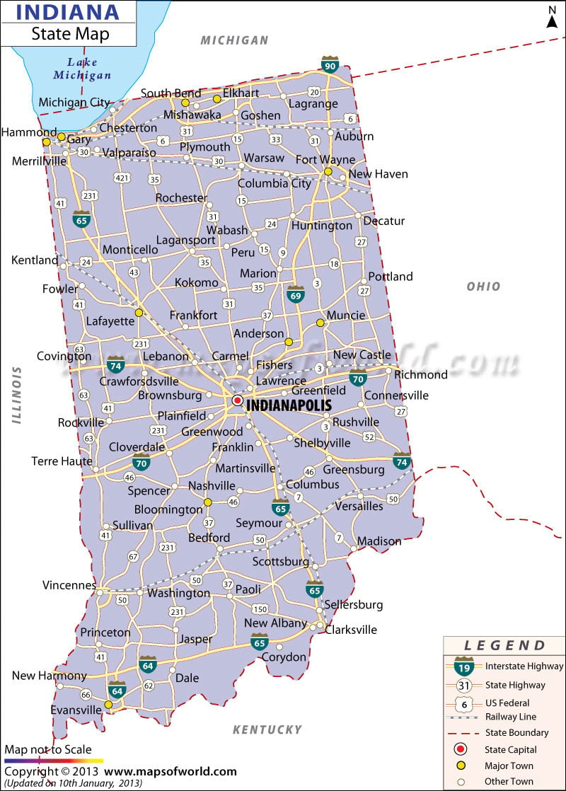
Indiana has a total area of 36,185 square miles, which includes 35,932 square miles of total land area and 253 square miles of inland water area. In terms of total area, Indiana is the 38th largest of the 50 states of the USA. In the map the capital city, Indianapolis, is prominently marked.
Towns like Anderson, Evansville, Ft. Wayne and St. Bend are also shown along with their respective geographical standing. Other cities and towns such as Scottsburg, Rockville, Madison, Princeton, Kokomo, New Albany, Martinsville, Marion, Lagrange, Gary, Lafayette, Rushville, Bloomington, Monticello, Decatur, and several others are indicated in the Indiana state map.
The extensive road network of 93,606 miles is vividly marked. Also, the railway routes that collectively cover 4,685 miles are shown on the Indiana state map. As a whole, the map offers an all-encompassing overview of the state, especially for those that are visiting for the first time, and is a significant illustrative guide that provides a lot of information regarding the area.

 Wall Maps