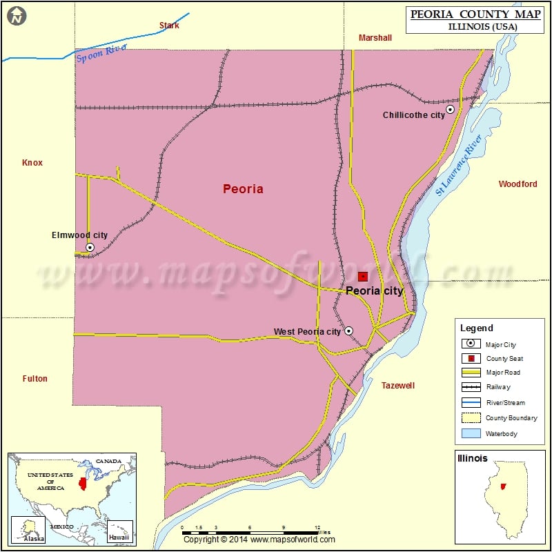
Peoria County Map, Illinois
Airports in Peoria County Airport Name Decatur County Hospital Heliport Delle, Utah Gordon Brown Airport Greater Peoria Regional Airport Methodist Medical Center of Illinois Heliport Mount Hawley Auxiliary Airport OSF…
Airports in Peoria County
Airport Name
Decatur County Hospital Heliport
Delle, Utah
Gordon Brown Airport
Greater Peoria Regional Airport
Methodist Medical Center of Illinois Heliport
Mount Hawley Auxiliary Airport
OSF Saint Francis Medical Center Heliport
Rainbow Heliport
Cities in Peoria County
City
Population
Latitude
Longitude
Bartonville village
6471
40.639721
-89.660876
Bellevue village
1978
40.688095
-89.673409
Brimfield village
868
40.838079
-89.883583
Chillicothe city
6097
40.915295
-89.50183
Dunlap village
1386
40.857534
-89.678838
Elmwood city
2097
40.780407
-89.965574
Glasford village
1022
40.572708
-89.813179
Hanna City village
1225
40.693234
-89.793948
Kingston Mines village
302
40.558619
-89.771177
Lake Camelot
1686
40.634152
-89.751015
Mapleton village
270
40.57294
-89.724725
Norwood village
478
40.707477
-89.700447
Peoria city
115007
40.751568
-89.615255
Peoria Heights village
6156
40.762813
-89.557352
Princeville village
1738
40.934808
-89.754664
Rome
1738
40.875272
-89.51286
West Peoria city
4458
40.699006
-89.632766
Golf Courses in Peoria County
Name of Golf Course
Latitude
Longitude
Arrowhead Country Club-Edelstein
40.923904
-89.610251
Country Club of Peoria-Peoria Heights
40.744626
-89.56429
Coyote Creek Golf Club-Bartonville
40.624115
-89.722216
Detweiller Park Golf Course-Peoria
40.788208
-89.577185
Howard D. Kellogg Golf Course-Peoria
40.781449
-89.650241
Leo Donavan Golf Course-Peoria
40.757586
-89.593324
Madison Park Golf Course-Peoria
40.682641
-89.636658
Maple Lane Country Club-Elmwood
40.788475
-89.965928
Mount Hawley Country Club-Peoria
40.780405
-89.602344
Newman Golf Course-Peoria
40.710567
-89.624149
Timber Lake Country Club-Peoria
40.697677
-89.68055
WeaverRidge Golf Club-Peoria
40.74932
-89.65408

 Wall Maps