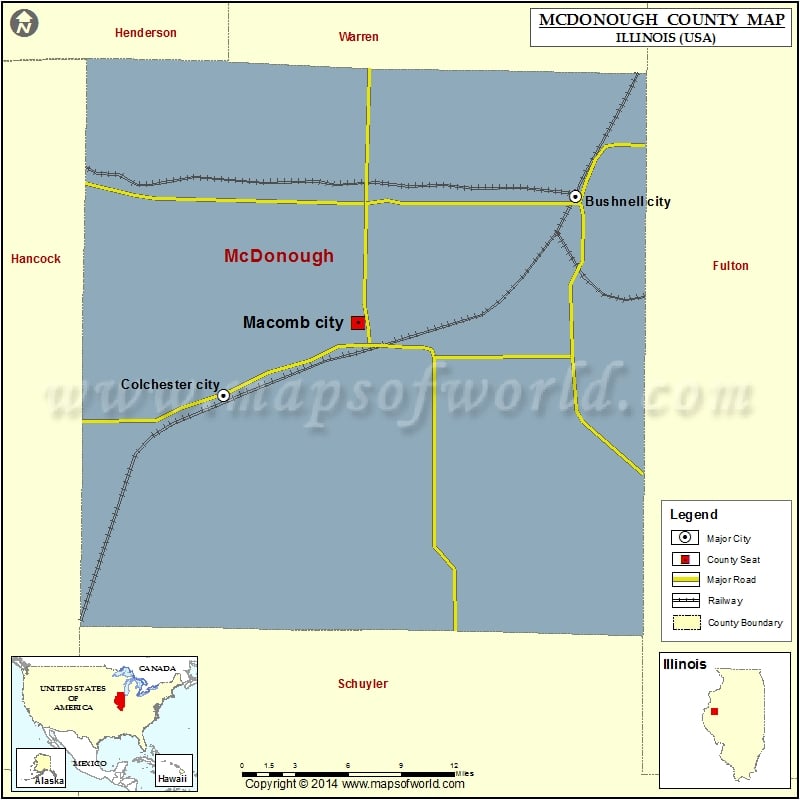
McDonough County Map, Illinois
Mountain Peaks in McDonough County Mountain Peak/Hill Elevation [Meter] Dyers Mound 221 Airports in McDonough County Airport Name Clark Airport Holyoke Airport Macomb Municipal Airport Mount Werner Heliport Munsterman…
Mountain Peaks in McDonough County
Mountain Peak/Hill
Elevation [Meter]
Dyers Mound
221
Airports in McDonough County
Airport Name
Clark Airport
Holyoke Airport
Macomb Municipal Airport
Mount Werner Heliport
Munsterman Airport
Rdh Farms Airport
St Francis Hospital Heliport
Cities in McDonough County
City
Population
Latitude
Longitude
Adair
210
40.418307
-90.497373
Bardolph village
251
40.496274
-90.563391
Blandinsville village
651
40.554139
-90.868055
Bushnell city
3117
40.551786
-90.504509
Colchester city
1401
40.427318
-90.792147
Georgetown
404
40.459834
-90.717372
Good Hope village
396
40.557454
-90.675539
Industry village
478
40.32696
-90.608182
Macomb city
19288
40.472265
-90.682218
Prairie City village
379
40.621025
-90.464906
Sciota village
61
40.562428
-90.748036
Tennessee village
115
40.411218
-90.836061
Golf Courses in McDonough County
Name of Golf Course
Latitude
Longitude
Gold Hills Golf Course-Colchester
40.441922
-90.734099
Harry Mussatto Golf Course At Western Illinois Uni-Macomb
40.485267
-90.693678
Macomb Country Club-Macomb
40.476365
-90.6653
Shaw Creek Golf Course-Bushnell
40.548781
-90.502733
Twin Oaks Golf & Country Club-Blandinsville
40.554926
-90.879479

 Wall Maps