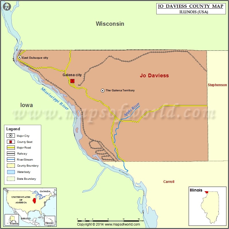
Jo Daviess County Map, Illinois
Mountain Peaks in Jo Daviess County Mountain Peak/Hill Elevation [Meter] Benton Mound 367 Charles Mound 376 Dygerts Mound 300 Heer Hill 279 Horseshoe Mound 324 Hudson Mound 356 Lost Mound…
Mountain Peaks in Jo Daviess County
Mountain Peak/Hill
Elevation [Meter]
Benton Mound
367
Charles Mound
376
Dygerts Mound
300
Heer Hill
279
Horseshoe Mound
324
Hudson Mound
356
Lost Mound
246
Mound Sumner
356
Pilot Knob
299
Scales Mound
355
Simmons Mound
327
Squirrel Grove Mound
355
Wenzel Mound
315
Airports in Jo Daviess County
Airport Name
Briggs Brothers Airfield
Foster Field
Heller Airport
John L Coppernoll Airport
Merkle Airport
Providence Place Field
Stauss Hospital – Galena Heliport
Stockton Airport
Cities in Jo Daviess County
City
Population
Latitude
Longitude
Apple Canyon Lake
558
42.430237
-90.164199
Apple River village
366
42.501961
-90.094624
East Dubuque city
1704
42.489201
-90.628572
Elizabeth village
761
42.31657
-90.218456
Galena city
3429
42.422253
-90.430379
Hanover village
844
42.254813
-90.270897
Menominee village
248
42.472175
-90.54322
Nora village
121
42.456323
-89.945465
Scales Mound village
376
42.477518
-90.2511
Stockton village
1862
42.352147
-89.999761
The Galena Territory
1058
42.395592
-90.315867
Warren village
1428
42.494293
-89.99069
Golf Courses in Jo Daviess County
Name of Golf Course
Latitude
Longitude
Apple Canyon Lake Golf Course-Apple River
42.420075
-90.157179
Blackhawk Run Golf Course-Stockton
42.323191
-90.019913
Eagle Ridge Inn and Resort-Galena
42.403318
-90.336961
Galena Golf Club-Galena
42.44707
-90.454897
Lacoma Golf Club-East Dubuque
42.488908
-90.627232
Storybrook Country Club-Hanover
42.234368
-90.255932
Woodbine Bend Golf Course-Stockton
42.335563
-90.157425

 Wall Maps