
 Wall Maps
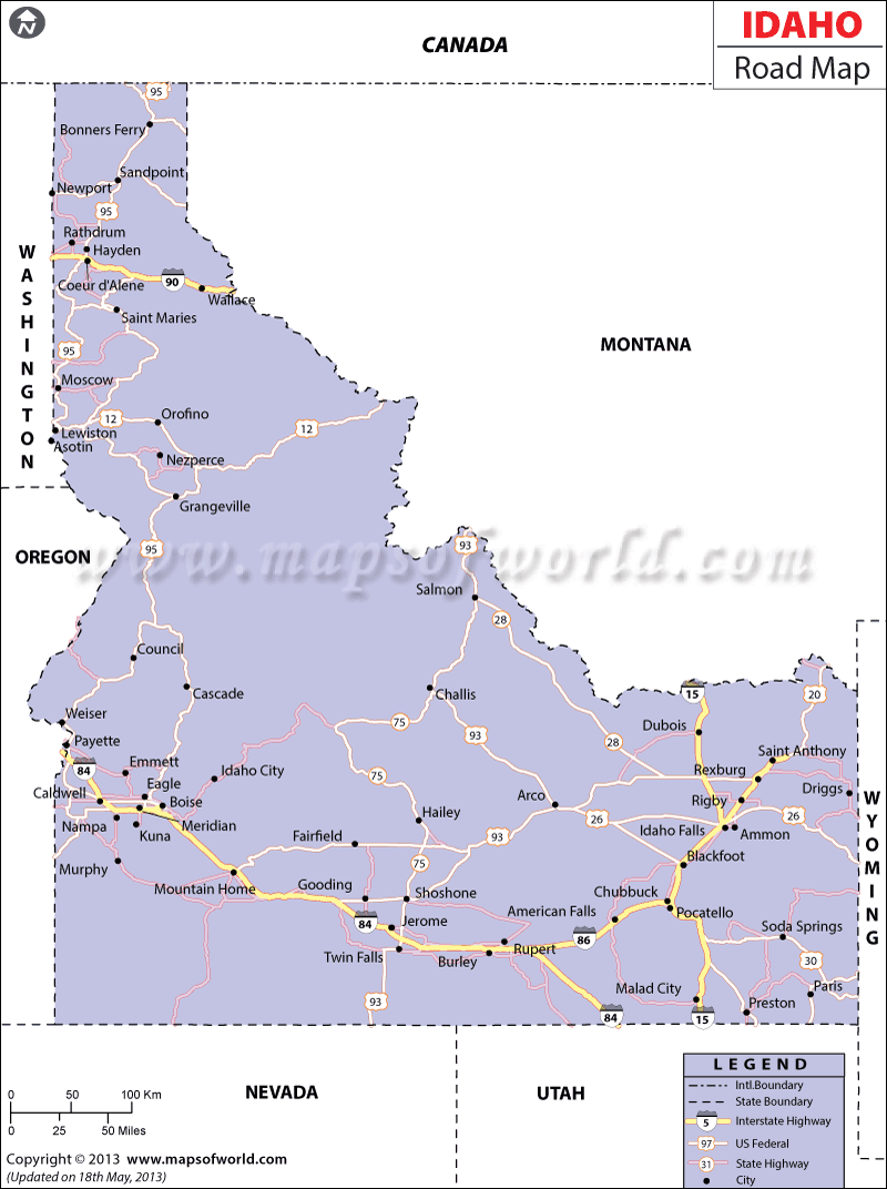
The Idaho Road Map indicates the several road routes, national highways and streets of the state. The Interstate Highway of 15 conveniently links the northern part of Idaho with the southern end of the state.
The eastern and western ends of Idaho are connected by the Interstate Highways of 90, 84 and 86. The State of Idaho had a total of 46,455.578 mile (74,763 kilometer) of roads and streets in the year of 2000.
There were 1,219,851 numbers of vehicles that were registered in 2000 and comprised 2,409 numbers of buses, 515,266 numbers of automobiles and 658,747 numbers of trucks. The national highways of I-84 and I-90 have made the eastern part of the state easily accessible to the western part of Idaho.
Some of the prominent routes joining the northern and southern parts of Idaho are US Highways of 95 and 93, Interstate Highway of I-15 and Idaho 55. Some of the important US Highways of Idaho are 26, 20, 93, 30, 91, 89, 95 and 12. The Idaho State Map prominently marks the important towns that are connected by the extensive roadways of the state. Malta, Mackay, Cascade, Arco, Boise, Stanley, Salmon, Challis and Cambridge are joined by the state and national highways of Idaho.