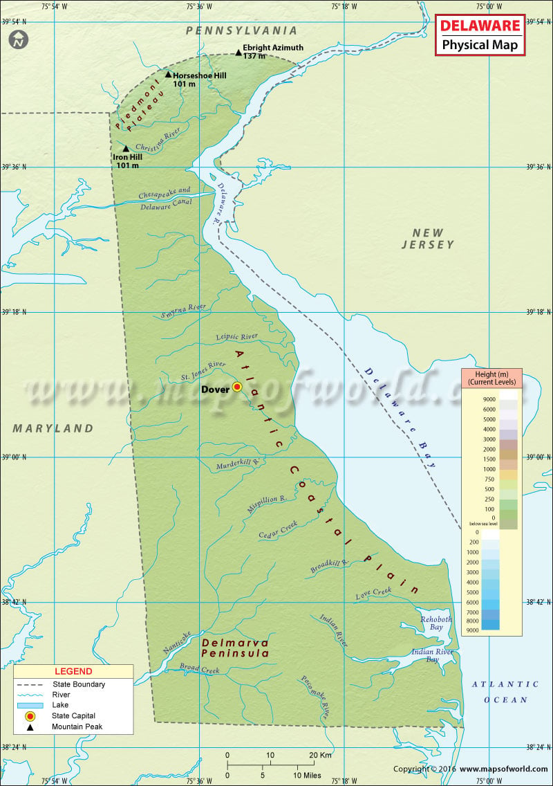
Delaware Physical Map
There are two major physical features in the state of Delaware: the Piedmont Plateau and the Atlantic Coastal Plain. Most of Delaware’s land is flatter, with a mean elevation of only 58 feet above sea level.
The Piedmont Plateau covers the northernmost edges of the state and gradually turns into the Atlantic Coastal Plain. The plateau is mostly covered in rolling hills and ridges. The coastal plain, in southern Delaware, is flat and sandy. The plain along the Atlantic Ocean features marshes and over 30,000 acres of swampland. The southern region also contains hardwood and conifer trees. Delaware’s eastern shoreline is home to a number of bays, tidal creeks, and marshes.
The Nanticoke River empties into the Chesapeake Bay towards west. The St. Jones, Peipsic, Mispillon and Smyrna rivers flow into the Delaware Bay towards east. The Delmarva Peninsula features a flat topography, with a few low-lying hills. The Ebright Road benchmark at 447.85 feet is the highest point in Delaware.
Major beaches in Delaware (from north to south):
Broadkill Beach
Rehoboth Beach
Dewey Beach
Bethany Beach

 Wall Maps