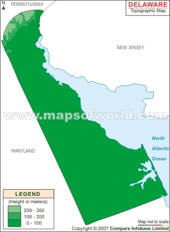
Delaware Topography
The northernmost region in the state is included in the Appalachian Piedmont and is made up of rolling surfaces and hills. The fall line of Delaware follows Robert Kirkwood Highway that is located between Wilmington and Newark.
The Atlantic Coastal Plain lies to the southern direction of the road and is filled with sandy and flat grounds that are swampy in parts. Close to the state’s western boundary there is a ridge that is almost 75 to 80 feet in height.
Delaware Geography
The total area of Delaware is 1,954 square miles, which means it is the second tiniest state in USA. According to the Delaware Topographic Map it shares its northern boundary with Pennsylvania and is surrounded in the eastern part by Delaware River, New Jersey, Delaware Bay and Atlantic Ocean. Maryland is located to the west and south of the state.
Smaller areas of the state can also be found on Delaware River’s eastern side and is surrounded by New Jersey.

