Pristine beaches, cutting-edge culinary scene, regal charm, and quaint coastal communities make Delaware state an ideal vacation destination.
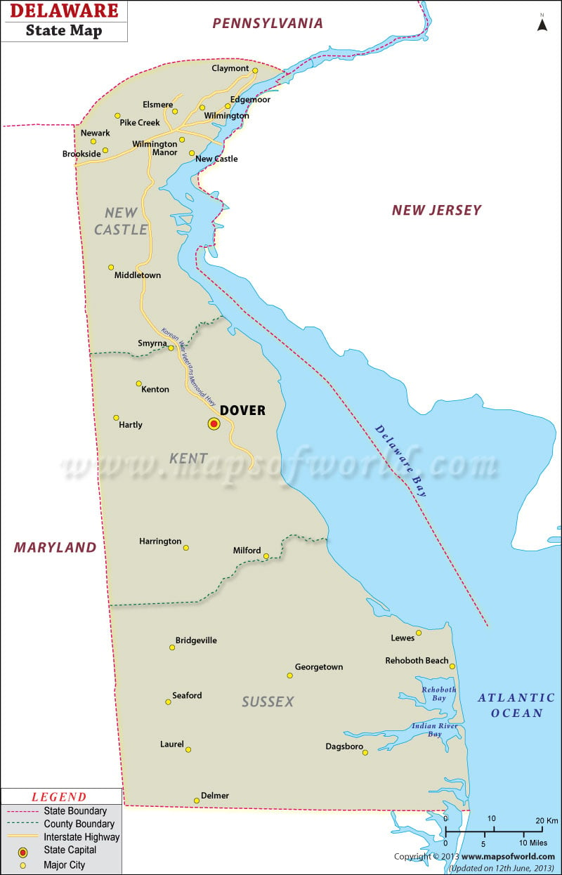
The state is divided into three counties: New Castle, Kent, and Sussex.
The capital of the state is Dover and Wilmington is the most populous city.
Tourist Destinations in Delaware
- Rehoboth Beach
- Bethany Beach
- Fenwick Island
- Brandywine Creek State Park
- Delaware Art Museum
Getting In and Around
The Wilmington Airport (ILG) is the primary commercial airport in Delaware.
Newark and Wilmington are served by Amtrak trains of Northeast Corridor.
Interstate highway I-95 along with six U.S. highways (US 9, US 13, US 40, US 113, US 202, and US 301) create a dense road network.

 Wall Maps