Connecticut Road Network
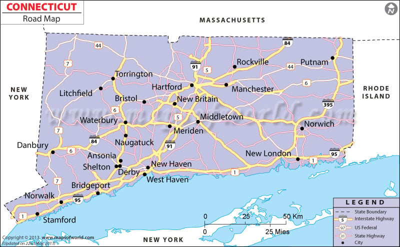
Connecticut Road Map indicates the wide network of roads which connect the various cities of the state.
The roads, state highways and expressways of Connecticut stretches to a total of 33, 546 km, as per an estimate of 2000. The important highways of Connecticut that play a major role in linking the cities of the state are l-84, l-91, John Davis Lodge Turnpike and l-95. While l-84 starts from Massachusetts Turnpike and passes through Danbury to New York state, Waterbury and Hartford, l-91 connects Springfield and New Haven. l-95 is also quite important as it intersects the whole state of Connecticut.
The Connecticut Department of Transportation supervises a range of vital issues related to daily traffic, construction of new roads and maintenance and repair of damaged roads. Buses are the prime mode of road transportation in Connecticut. Inter-city bus services are quite regularized in the state of Connecticut. Local people and tourists can easily avail of the subsidized bus rates fixed by the Connecticut state. The diverse road routes and the respective connectivity can be clearly found in the Connecticut state map. Those who are visiting Connecticut for the first time, for them, road map of Connecticut provides a ready reference.

 Wall Maps