Connecticut Rail Network
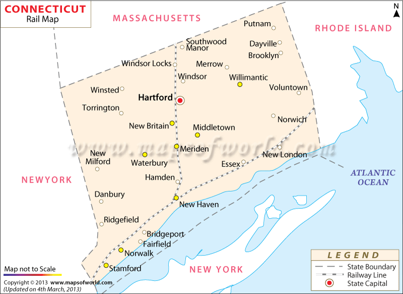
Connecticut Railroad Map shows the extensive track routes that are spread across the length and breadth of the state.
According to one estimate of 2000, about 1195 km of railroad is currently available in Connecticut state. During 1890s the railroads of Connecticut gained momentum and covered a total track area of 2633 km. The year of 1976 was quite important as Consolidated Rail Corporation of Connecticut was established. Metro-North Railroad is one of the significant railway service providers of Connecticut.
Around 900 trains operate on an average weekday from Connecticut and New York for the 250, 000 customers of Metro-North Railroads. Amtrak is another major railway transportation service provider which offers trains to Springfield Line and Northeast Corridor main Line. While the northeast corridor line includes New Haven, Washington DC, New York City, Boston and Philadelphia, Springfield Line covers Hartford and New Haven.
The Connecticut state rail map provides a complete idea about the various rail routes of the place. Apart from local inhabitants, tourists who travel by trains often find the railway map of Connecticut quite useful as it mentions the tracks of trains passing through cities and towns of the state. As a whole, the Connecticut railway map provides a comprehensive overview of the train services.

 Wall Maps