 Wall Maps
Explore the Map of Garfield County, CO, USA. Garfield County Map, Colorado shows the county boundaries, the county seat, major cities, roads, railroad, zip codes, area codes, and tourist attractions.
More Maps of Garfield County

Explore the Map of Garfield County, CO, USA. Garfield County Map, Colorado shows the county boundaries, the county seat, major cities, roads, railroad, zip codes, area codes, and tourist attractions.…
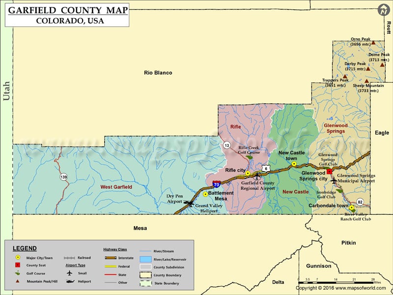
Explore the Map of Garfield County, CO, USA. Garfield County Map, Colorado shows the county boundaries, the county seat, major cities, roads, railroad, zip codes, area codes, and tourist attractions.
More Maps of Garfield County
This website uses cookies to improve your experience. We'll assume you're ok with this, but you can opt-out if you wish. Read More