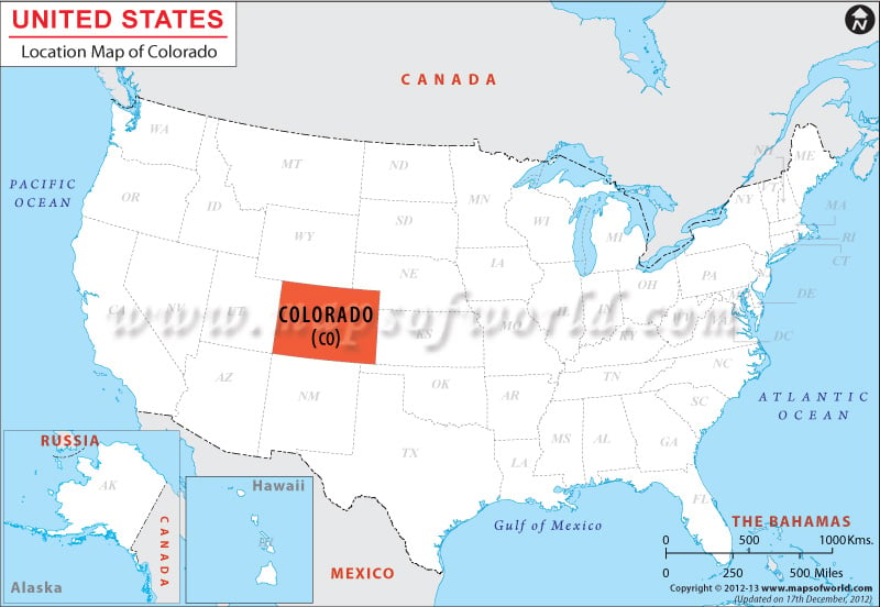
Location of Colorado in USA
Colorado is surrounded by Nebraska and Wyoming on its northern front, by Kansas and Nebraska on its eastern front, by New Mexico and Oklahoma on its southern front, and by Utah on its western front.
Colorado has a total boundary length of 1,307 miles. Colorado is spread over total area of 104, 092 square miles, which includes 103,595 square miles of total land area and 496 square miles of total inland water. The State of Colorado stretches at a length of 387 miles east-west, and 276 miles north-south.
Colorado is situated in the Rocky Mountain Range, at the coordinates 39.0° N, 105.5° W. within the United States, occupying a total area of 104,094 square miles (269,837 square kilometers), making it the eighth largest state in the country. Colorado is bordered by Wyoming, Nebraska, Kansas, New Mexico, Oklahoma, Utah, and Arizona. Colorado, along with New Mexico, Arizona, and Utah all meet at one point, called Four Corners.
Facts About Colorado |
|---|
| State | Colorado |
|---|---|
| Country | USA |
| Continent | North America |
| Capital and largest city | Denver |
| Area | 104,094 sq mi (269,837 km2) |
| Population | 5,355,866 (2014 est) |
| Lat Long | 39° 0′ 0″ N, 105° 30′ 0″ W |
| Official Language | English |
| Calling Code | 00 1 303 X |
| Time Zone | Mountain: UTC-07/UTC-06 |
| Airport | 13- Airports Commercial Service |
| Neighbour State | Kansas, Nebraska, New Mexico, Oklahoma, Utah, Wyoming |
| Internet TLD | |
| Currency | United States Dollar (USD) |

 Wall Maps